Brazos River, College Station
July 18, 2020
by John Rich
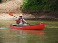
Seven paddlers showed up at 8 am on Saturday morning to paddle the Brazos River west of College Station, Texas. The trip organizer was Bruce Bodson. The group boats consisted of 5 hardshell kayaks, 1 inflatable kayak, and 1 canoe.
We met at the take-out location under the FM-60 bridge over the Brazos. There, we consolidated as many boats as possible onto as few vehicles as possible, for the drive to the put-in location. This left as many vehicles as possible remaining under the bridge, ready and waiting upon completion of the trip.
We then ran our shuttle from FM-60 going west to Hwy 50, north on Hwy 50 for 8 miles to State Highway 21, and back east on SH-21 a few miles to the river again. Total shuttle distance is about 11 miles. The river distance between these two points, with all its meanders, is 15 to 16 miles. One large loop near the end is 2.5 miles all by itself.
| Click photos to enlarge |
 |
|
 |
| Road map |
|
Aerial map |
The water level was at its usual low state, with the current moving a leisurely 1 mph. So, it wasn't going to be a free ride - we were going to work for and earn these miles. Everyone stuck to the outside of the bends where the current is swiftest, to get as much push as they could to ease the burden. The nearest U.S. Geological Service water gauge upstream is at Highbank, Texas, about 45 miles north.
The put-in difficulty level was low for the Brazos. The bank was a little steep, but sand instead of mud, and not very long. Just position your boat at the top and slide it down, letting gravity work for you. There was mud at the waterline. My first chore after pushing off was to remove my shoes, wash them over the side, and mop up the mud in the boat with my bailing sponge, so I wasn't wallowing and slipping in the mud all day. Par for the course for the Brazos.
The old iron truss railroad bridge alongside State Highway 21 over the Brazos River is called the "Whiskey Bridge", because College Station was formerly a dry county that didn't allow alcohol sales, so to get a drink of whiskey you had to cross this bridge into the next closest county which did sell alcohol.
It's also the site of Eocene era rocks in the west riverbank, which are dug through by fossil hunters looking for marine fossils that are 40-million years old, from when south Texas was part of the Gulf of Mexico. Some of the fossils to be found there are snails, mollusks, shark teeth and corals.
 |
|
 |
|
 |
| Dual SH 21 bridges |
|
Whiskey Bridge |
|
Put-in |
Participants:
 |
|
 |
|
 |
|
 |
| Bruce Bodson |
|
David Portz |
|
Brent Hwang |
|
John Rich |
This river section was mostly standard unremarkable Brazos, with an exception I'll cover in a moment. There were no rapids, and just a few riffles. The riffles were wide enough that you could hear the roar of water ahead flowing over the gravel bar before you could see it, giving you that thrill of knowing something exciting might be ahead. There were areas with snags in the river, where trees have eroded out of the riverbanks and been left embedded in the river, but there was plenty of room to maneuver around them.
We stopped every hour and a half or so at a gravel bar to stretch our legs, and look for fossils. There were small fragments of petrified wood to be found, and Bruce came upon a horse tooth. And there was the usual assortment of modern junk that people throw in rivers, like car tires and household appliances.
The temperature was in the mid-90's, but there was a pleasant breeze blowing which helped you feel not-so-hot. After a dip in the river, the breeze actually made you a little chilly. The breeze was a slight inconvenience for my canoe, as it wanted to blow my bow around and I had to fight it some to maintain a course. But put the paddle down for two seconds to take a picture, and spin like a weather-vane!
 |
|
 |
|
 |
|
 |
| On the river |
|
Pulled ashore for
a rest break |
|
Dead trees fallen
into the river
and washed ashore |
|
Oil well peeking
over the top |
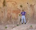
Brazos River geology is always interesting. At least it is to me. The high eroded banks on the outside arc of the bends exposes all the various stratigraphic layers of the earth. I just wish I knew what the different colors meant and how old they were. There were parallel white lines as straight as a laser beam. Colors of reddish-brown, black, gray, white, tan and shades in-between. I'm pretty sure all but the top layer is well before the Holocene, the current era, prior to human presence. And there was one section that was different from the usual colored clay layers - it reminded me of the bluffs along the Buffalo River in Arkansas. There's never a geologist around when you need one.
 |
|
 |
|

|
|
 |
| Parallel white lines |
|
Bank strata |
|
Strata colors
|
|
Uncharacteristic
bluffs |
And then there was the remarkable part of the scenery - petrified wood! There were large logs of it in several places. I'm used to finding only hand-sized fragments on gravel bars, but here were entire stumps and large sections of logs, and they had visible bark and growth rings. I believe these are ancient conifers from the last ice age, about 25,000 years ago.
 |
|
 |
|
 |
|
 |
| Lumpy rock |
|
Petrified wood
log jam |
|
Petrified wood |
|
Petrified wood
|
After about 7.5 hours on the river, we were at the take-out at FM-60. This was the usual Brazos nightmare. It started with a muddy shoe-sucking shoreline with a steep drop-off into deep water. Then there was concrete rubble for erosion control, very large chunks, sharp edges, uneven, difficult to negotiate around and over, scratching gouges in the bottom of your boat. Once you got past the rubble, then there was the steep sandy bank, the kind of sand where for every step upward, you slide back down half a step. Thank goodness for the energy of the younger, stronger guys, who helped everyone get up the hill.
Once atop the bank, the boats were loaded onto the vehicles left behind at the beginning of the trip. All the boats and people were shuttled back to the put-in to be re-united with their own vehicles, and boats switched over. There was drama with one shuttle vehicle carrying five boats when the roof rack started to come loose. They solved that issue and arrived late. Another problem was when I placed my gear in the back of a pickup truck that I thought belonged to our group. Turns out, it didn't. The truck and my gear never arrived. Racing back to the take-out, the truck was still there with my gear in back - I got lucky that it wasn't stolen.
 |
|
 |
|
 |
| Take out bridge ahead. |
|
Up the bank |
|
Loading up |
'Twas a fine day on the water. Thanks to Bruce for organizing it, and for the pleasant nature of all the paddlers.
|
|
The author, John Rich |