Trip Report: Old River from Joe Matthews Park, Mont Belvieu
Sunday, January 18, 2026
Trip facilitator: Natalie Wiest
Members also participating: Eloise Catrett, Lisa Kinsey, Alice Nissen, Mike Pollard and Ellen Shipman
Distance paddled: 3.6 miles (an out and back trip)
Meteorological: temperature range 45 degrees to 51 degrees
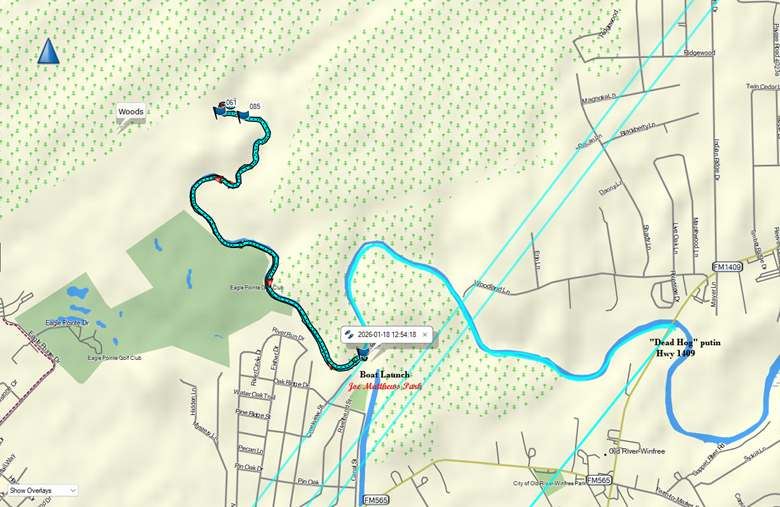
USGS gage 08067215 downstream approx. -.75
Six of us set off in 5 watercraft by 11 a.m. on the 18th. The beautiful warm 75 degree day of two days previous had degraded to a much cooler range of temperatures, about 45 when we put our boats on the water to 51 by the time we took out. I had moved the original start time of 9 a.m. back to 10:30 a.m. to allow for a warmup from the even cooler start of the day. It was nice and warm in the sun – but the area we paddled was shaded for almost its entirety, so it felt good to maintain a steady pace.
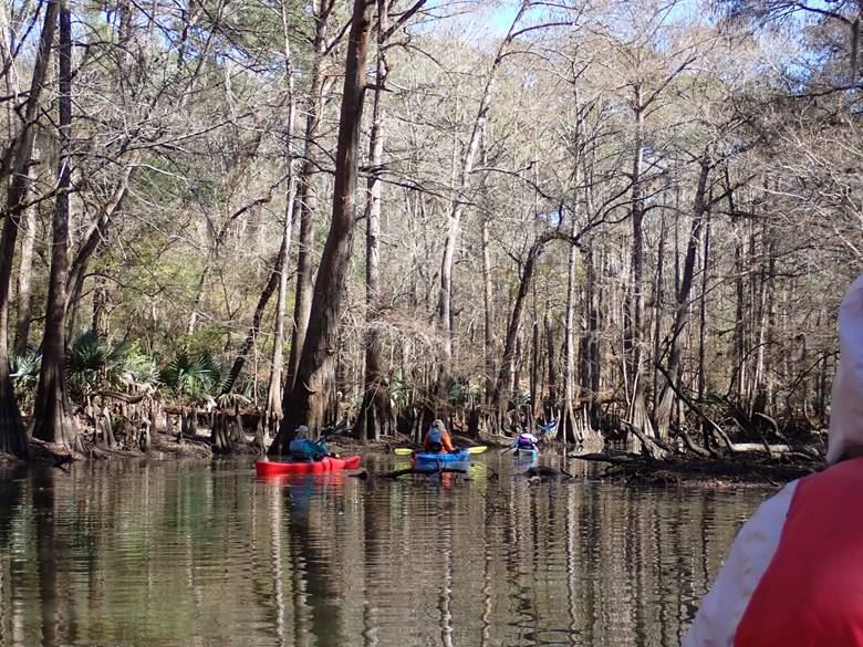
One of the natural features I enjoy along the Old River is the palmetto stands along its banks.
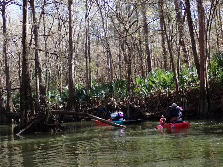
If timing is right in the fall the rusty orange of the cypress trees is always pretty but as you can see by this date the leaves have dropped. Our route took us upstream, past some big houses, then the Eagle Point golf course but always woodland on the right bank. Our pace was leisurely and it was a short paddle. A log across the width of the stream limited our upstream paddle. If you would like to make a longer paddle Old River is paddleable for at least two miles downstream from Matthews Park to the highway 1409 crossing and on to the Cutoff if you’d really like to add a lot of miles to your paddling day.
My curiosity about the utility of the new boat ramp at Matthews Park was part of the incentive for trying this route. Ellen and I had scouted it the week before and I was concerned that the low water of that day would make it very challenging. The end of the scooped-out part of the ramp was 6” out of the water.
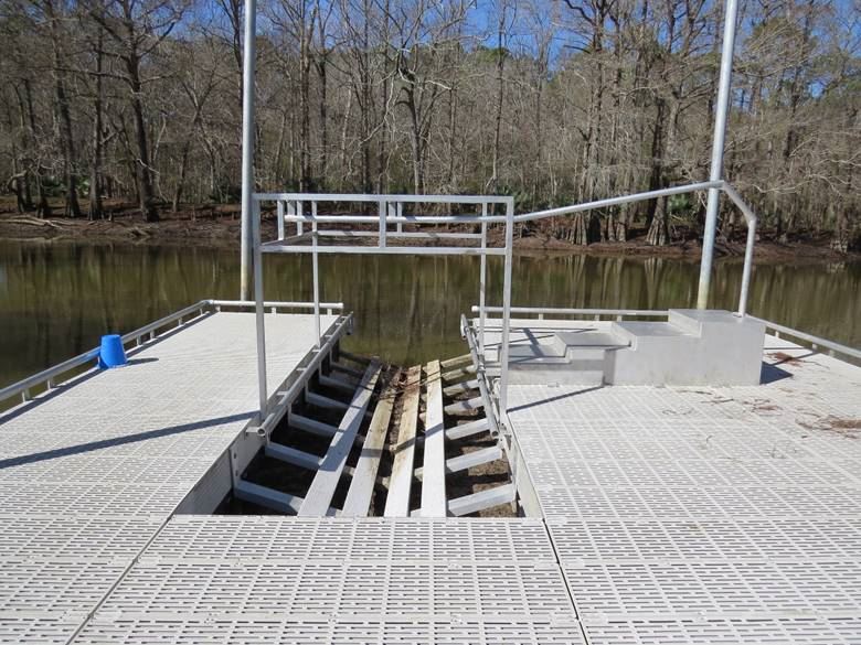
Note there is no water at all covering the end of the ramp. Thankfully when we arrived on the 18th there was about 6” covering the end of the ramp and water extended up to about the 5th rib.
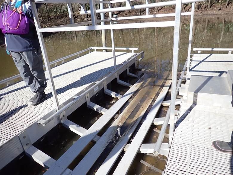
The south winds that had predominated earlier in the week had blown water up into the river from the lake. Sure enough, the north winds that prevailed while we were paddling had the opposite effect and the ramp was drier on our return but thankfully still usable. FWIW, this is the most user-friendly of the constructed canoe/kayak ramps I have used.
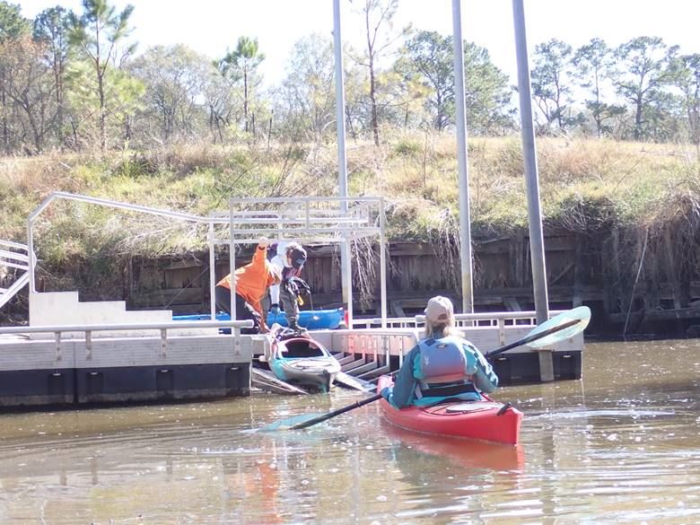
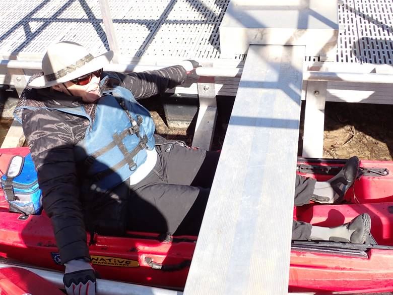
Designed to be handicapped-accessible it even has a slide-out ramp to facilitate getting into a floating boat, and a very useful superstructure to ease the transitions in or out.
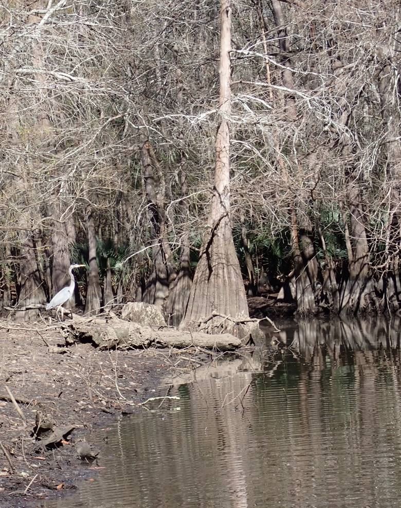
Here’s a great blue heron that was very cooperative in allowing its picture to be taken, and to show the exposed riverbed at low water.
It was a lovely day on the water and we warmed up and feasted at Iguana Joe’s restaurant afterward.
Here’s a map of our route also showing the potential downstream paddle.