I have heard of the Allagash canoe trail for years and it was on my bucket list – took no convincing by trip coordinator Karen Newcomb to join her for a trip in July 2022.
Our route on the Allagash Wilderness Waterway (AWW) was 90 miles of paddling from the putin at Chamberlain Bridge to the takeout upstream of the town of Allagash.
AWW is one segment of 740 miles of the paddleable waterway known as the Northern Forest Canoe Trail. The Allagash is managed by the Maine Bureau of Parks and Lands and includes protection of the natural features combined with the private logging roads and private property. It’s a rugged wilderness area and we found our shuttle money well spent on the 4-hour drive to the putin from the town of Allagash. We rented two heavy duty (and weight) canoes from our shuttle company, Allagash Guide Service.
Bob Scaldino and Karen Newcomb paddled one canoe, and my longtime friend John Diehl and I the other. Here we are loading up the canoes at the putin, Chamberlain Bridge in the background.
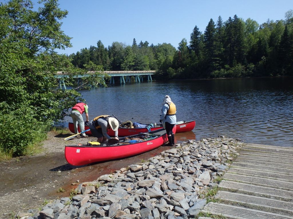 Loading Canoes
Several miles downstream, which means north for the Allagash system, we came to Lock Dam and its required portage. John brought a most useful shuttle cart for the 90 lb canoes plus gear.

Useful Shuttle Cart
The trip combined both lake and river paddling, including a fun little whitewater stretch below Churchill Dam. Below is the view on Chamberlain Lake. Unlike the Houston area where the prevailing winds are from the south, we encountered some very strong northerly headwinds although thankfully only for a few days. Sometimes I wonder if it’s a law of the universe that no matter which way is downriver, the wind will always be in the paddler’s face.

Chamberlain Lake
This area of Maine was and is heavily logged. In the late 1920s a short rail line was created to move logs between Eagle Lake and Umbazooksus Lake. When it became unprofitable, the engines, cars, and rail line were abandoned.

Below the Churchill dam was a pleasant Class II whitewater run. We considered the heavy boats laden with all our camping gear would be more difficult to maneuver than we wanted to chance so for a very reasonable fee of $10 per boat we paid the ranger to transport our gear to the bottom of Chase Rapids. Sorry I didn’t get any good photos of the whitewater run – it was fairly continuous, and I wasn’t in a good position to be taking photos while dodging rocks.
One of our campsites was at Scofield Point, and here is John lugging gear to the campsite

Over John’s left shoulder (right in the picture) you can see the ridgepoles and picnic tables that were included at every campsite. It was very convenient for rigging a tarp. Although we had rain several times, it always happened when we had the tarp already rigged and we were very happy for the facility. Next photo is Bob, the master tarp rigger and chef, at our camp.

Bob, the Master Tarp Rigger and Chef

Mornings were Still and Beautiful
The longest portage of the trip was around Allagash falls. It was a doozy of portage. Although it was only 300 yards, it was an up and down slog and only a small portion was amenable to using the portage cart. We were pleasantly surprised to have no competition for campsites here, or anywhere else on our trip. Here’s what the falls look like. Maybe you can’t tell much of the scale in the still photo, but the drop is 40-foot from top to bottom and with 2000 cfs running down it, was surely a Class VI if it was survivable at all.

Class Five
The free-flowing river and riffles the rest of the trip were quite enjoyable. Serious headwinds on Umsaskis Lake were a challenge. An incredible windstorm featured wind gusts that toppled trees around our campsite but thankfully not on our tents. All in all, a trip where the high temperatures were only into the 80s and most nights in the upper 50s or low 60s was delightful. I hope someday I’ll be able to return to this beautiful area.

This is my short and sweet trip description. If you’d like to hear and see in much greater detail, plan on coming to the Houston Canoe Club meeting in January when I’ll do a full presentation including details of packing, camping, wildflowers, and gear guy Bob will share his insights. You can join us online or in person at Bayland Community Center. See you there, or thanks for checking in on the brief version.
Cheers,
Natalie Wiest