Pelican Island Circumnavigation
July 5th, 2014
by Natalie Wiest
Saturday, July 5, I was awakened by loud, rumbling thunder at 5 a.m. OH NO, I’m thinking, now what do I do about the planned trip around Pelican Island? Most participants would be driving some distance for the 9 a.m. start, so how early should I call them if we decide to call it off? I checked the online forecast and the percentage was diminishing later in the day, and the storms were small, scattered, and not apparently streaming for Galveston, so decided I’d just call it from the put-in.
Eager participants were there even a half-hour early as I rolled up. Good omen for the trip and no thunderheads on the horizon now, so we talked about it before pushing our boats into the channel and heading west and north for the Intracoastal Waterway (ICW) cut in Pelican Island. Here you can see us heading in that direction, Texas City in the background with a cloud above it.
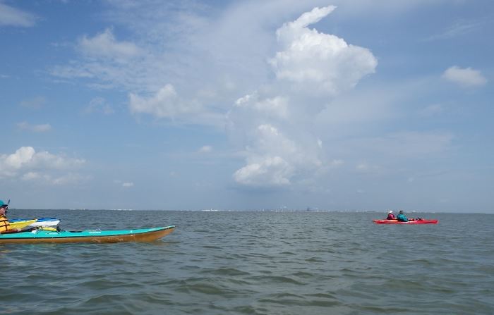
You may be able to see dark specks silhouetted in front of the cloud; that is a flock of brown pelicans. We always had some of them in view and on occasion they would crash land around us as they dove for fish. Ever-elusive-to-the-photographer dolphins were frequent visitors too. I saw more of them in more locations than I remember seeing; there is a pod that lives right off the shell beach there at the university; there were pods about where I took the photo beside the western edge of Pelican Island; they were in the ICW, and as ever all along the Galveston channel.
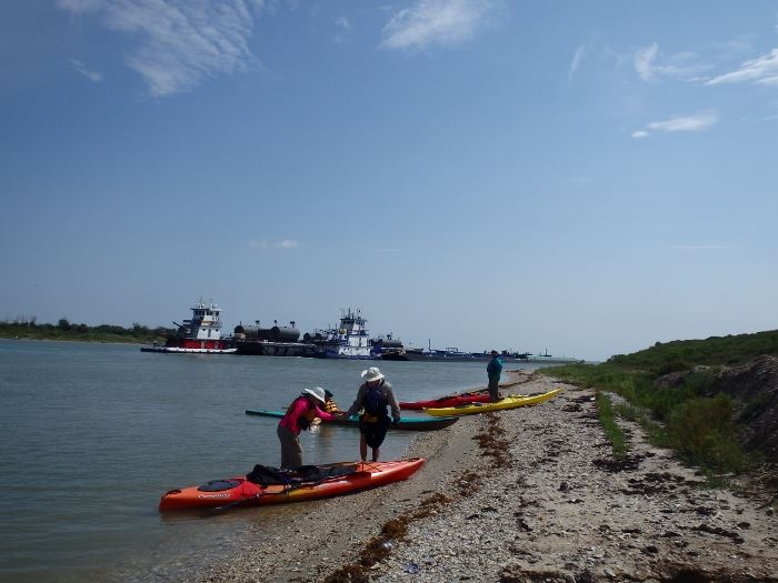
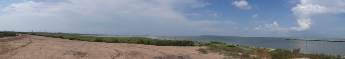
I always enjoy stopping for a break at the ICW (IntraCoastal Waterway) cut at Pelican Island. There is always something interesting to see from there, one of the highest spots on the island. Here is a panorama shot looking to the west and the Galveston causeway:
We’re on top of the dredge spoil bank watching barge activity on the ICW. You can see the long tandem barge across the way from us, and on our side of the cut farther down are three more barges, two of them side by side. And, as we’re about to pull out, here comes a pushboat without a barge, passing a double-wide barge underway right in front of us and between all those parked barges:
Karen’s really not as close to the barges as the photo would suggest and we were pleased to see the pass-through go on without incident.
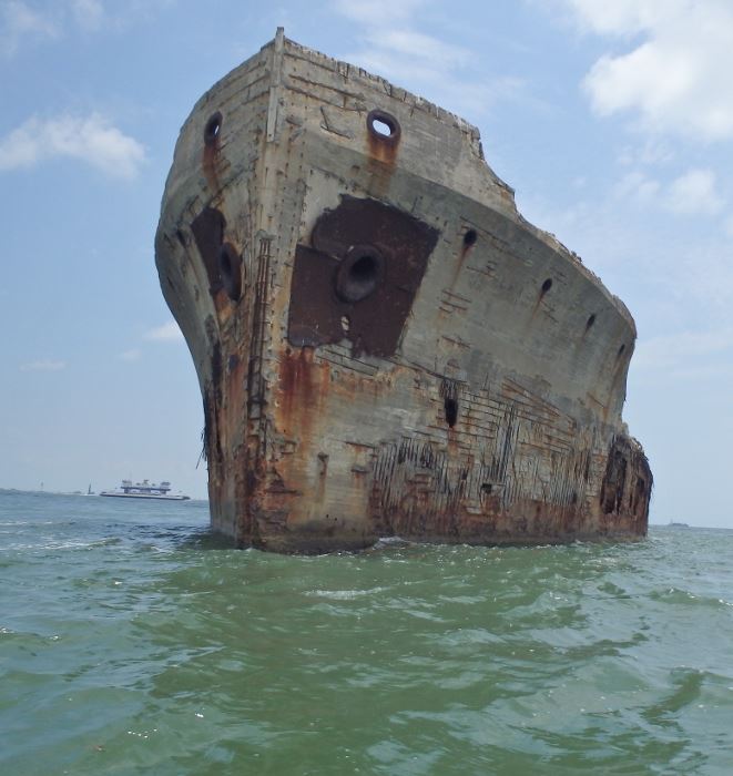
This was a nice warmup to the longer, and as it turned out, more grueling paddle into the wind and waves on the Houston Ship Channel side of the island. As we paddled, the wind shifted from due east, to due south by 1 p.m., and it was blowing from 10-15 mph giving us a little challenge. Although we had seen big oceangoing ships in the channel from our vantage point along the ICW, none of them passed as we paddled, but there were plenty of waves without the wakes, especially as we got nearer to the Galveston Channel and the busy ferry traffic. More than one of our paddlers were very glad to see the next rest stop come up, around the point from Seawolf Park although we took a brief paddling break to look at the Selma concrete ship.
That’s one of the Galveston ferries in the background.
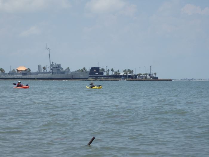
Here we are coming around Seawolf Park and the submarine and cruiser on exhibit there.
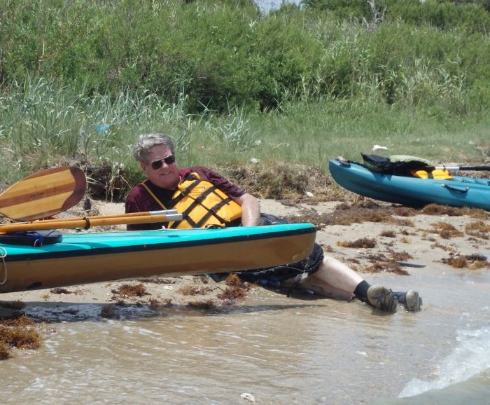
Mark Andrus is enjoying the break from paddling:
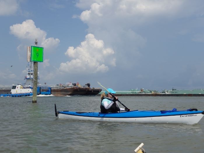
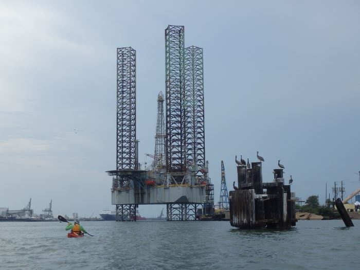
There is always a lot to see in the Galveston channel. Dolphins are almost always there and they were this day. Terns and pelicans were diving for fish. The Coast Guard station and ferry terminal are at the eastern end. Carnival Triumph cruise ship was at the dock, as was the tall ship Elissa, and there is always an assortment of offshore and marine heavy equipment, the tug boat terminal, Galveston harbor pilots ship and lots more. Harbour tour boats passed us several times, I’m sure we were entertainment for them. I like this photo as an example of the channel: the offshore rig Wisconsin has been here for quite a while, but there’s a pillar full of brown pelicans, and of course a kayaker:
I have always paddled the island in a clockwise direction. I base that decision on wind speed and direction, tides and associated current flow, and my best guess of which will be the less tiring combination. With a 360 degree rotation, somewhere along the way there will certainly be some challenges. High tide was forecast for 10:30 a.m. (at the Galveston pier 21) so my expectation was to have current with us as we headed down that east side of the island next to the Houston Ship Channel.
At 10 miles, and wind exposure a given on several legs of the journal, it can be a real workout. The Physical Oceanographic Real Time System from NOAA has lots of useful information for this area. Here are a few screen shots of the conditions we faced on this trip:
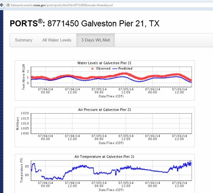
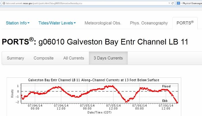
Although these are two separate gauging stations, notice how the current flow (and it is 13’ down in the Houston Ship Channel but presumably similar to the surface) parallels the tide observation. My interpretation is an inflow with the falling tide to about noon (close to high tide); then an outflow after noon, when we would be paddling beside the channel. It’s an oversimplification on my part I’m sure, but as noted – my best guess. And against that you have the wind direction. That’s what makes navigation challenging.
Our weary trip participants were: Mark Andrus, Diana Cooper, Cindy Cox, Sophie Lopez, Bill Ohsie (HASK), Karen Newcomb, Ken and Dylan Pape, and myself.
One other note – thumbs down on my new paddling hat. The brim is NOT stiff enough to pass muster; I’ve got a weird-looking sunburn above my eyebrows thanks to the brim blowing straight up every time we were paddling into the wind; and pinkness also on my arms. Hadn’t thought of it, but when my lightweight cotton shirt gets wet (and I got in the water with it on), it becomes more translucent. Oh well, no real harm done and I thoroughly enjoyed the paddle. Glad you were along for the ride!
More of Natalie's photos are here: Flickr
Kenny and Dillon Pape's photo album is: Here
 |
| The author, Natalie Wiest |